

Description
Texas Offshore Fishing Spots – 402 GPS Waypoints
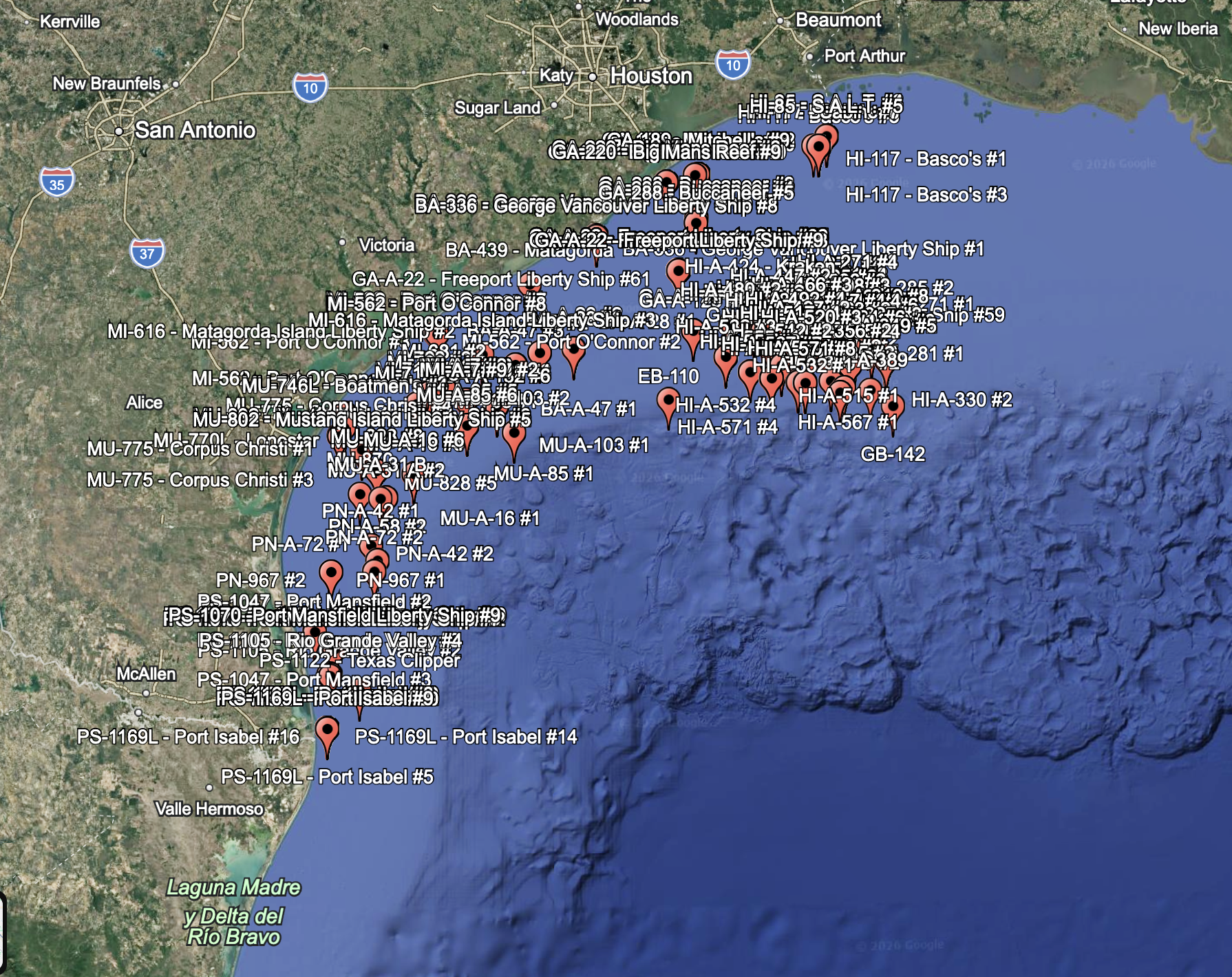
Take the guesswork out of finding productive water along the Texas coast. This dataset includes 402 verified offshore fishing spots, featuring artificial reefs, wrecks, and structure-rich locations known to hold fish.
Whether you’re targeting snapper, kingfish, cobia, or other offshore species, these coordinates give you a serious edge.
📍 What You Get
- 402 Texas Offshore Waypoints
- Artificial reefs, wrecks, and structure sites
- Clean, organized, and ready-to-use files
Included File Formats:
- .GPX – Compatible with Garmin, Simrad, Lowrance, Raymarine, and most modern chart plotters
- .KMZ – View instantly in Google Earth
- .CSV – Open/edit in Excel or import into various apps
⚙️ Optimized for Real-World Use
- Waypoints formatted for maximum compatibility
- Clean naming and descriptions (no clutter or broken formatting)
- Depth and structure details included where available
- Multiple structure points per reef for better coverage
🎣 Why This Matters
Finding offshore structure takes time, fuel, and experience. This dataset helps you:
- Spend more time fishing and less time searching
- Quickly locate productive structure
- Explore new areas with confidence
- Build milk runs faster
💻 Instant Digital Download
After purchase, you’ll receive immediate access to download all files.
⚠️ Important Notes
- These are publicly available reef and structure coordinates, compiled and formatted for convenience
- Always verify conditions and navigate safely
- Use at your own discretion
🔥 Perfect For:
- Offshore anglers
- Charter captains
- Weekend fishermen
- Anyone looking to expand their fishing spots
Get on the fish faster with a proven set of Texas offshore coordinates.
FAQ’s:
Is this a subscription?
No. This is a one-time purchase. Buy it once, download the files, and they’re yours to keep.
Are these private fishing spots?
No. These are not private honey holes or secret spots. The waypoints are based on publicly available reef, wreck, and offshore structure data published through state, county, and public marine records.
What file formats are included?
The bundle includes GPX, KMZ, and CSV files, along with basic instructions.
Will this work with my chartplotter?
The included GPX file is compatible with many modern Garmin, Simrad, Lowrance, Humminbird, and other marine electronics. Exact import steps may vary by brand and model.
Can I view the spots before loading them to a chartplotter?
Yes. The included KMZ file can be opened in Google Earth, and the CSV file can be opened in spreadsheet software.
Important Notes
These waypoints are based on publicly available reef, wreck, and offshore structure information that has been cleaned, organized, and converted for convenient use.
Coordinates should always be used with good judgment, current charts, safe navigation practices, and local fishing regulations.
This is not a navigation safety product. Always verify water depth, obstructions, restricted areas, seasons, closures, and regulations before fishing or navigating to any location.


Reviews
There are no reviews yet.