
Description
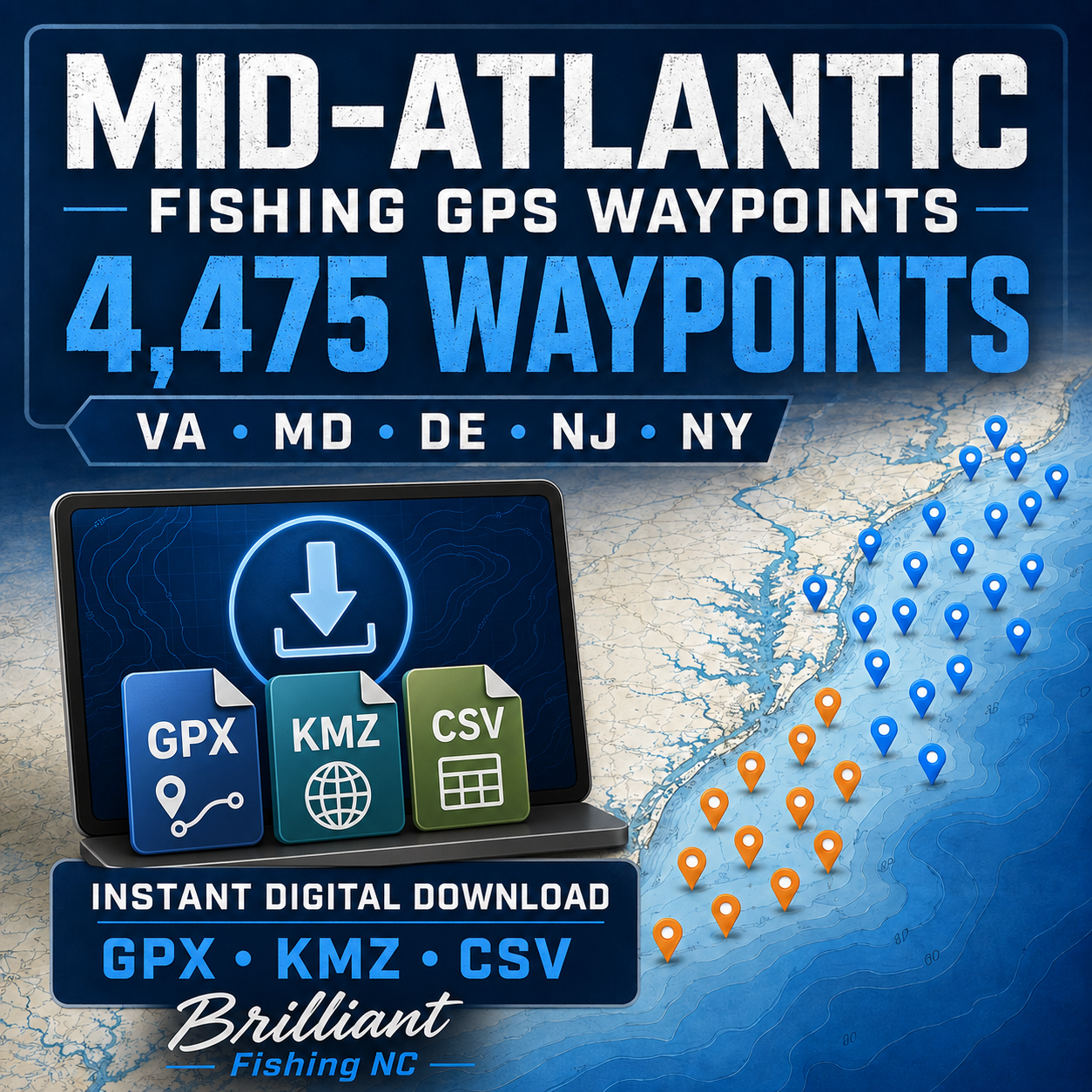
MID-ATLANTIC FISHING GPS WAYPOINTS
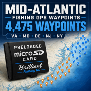
4,475 LOCATIONS • VA • MD • DE • NJ • NY
Get a major head start exploring artificial reefs, wreck areas, offshore structure and other saltwater fishing locations throughout the Mid-Atlantic.
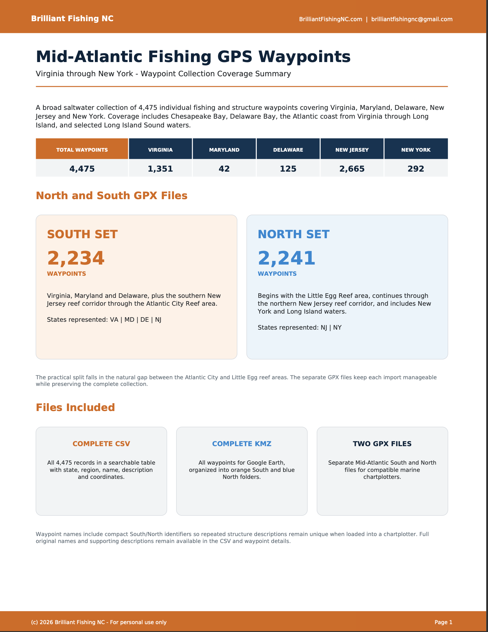
This organized collection contains 4,475 individual GPS waypoints spanning Virginia, Maryland, Delaware, New Jersey and New York. Coverage extends from Virginia’s Chesapeake Bay, Eastern Shore and offshore waters north through Maryland, Delaware Bay, the New Jersey reef corridor, Long Island and Long Island Sound.
A BETTER STARTING POINT
Instead of spending hours locating, organizing and converting thousands of individual coordinates, you receive a ready-to-download collection in several commonly used GPS formats.
The GPX collection is divided into North and South files to make chartplotter imports more manageable.
SOUTH GPX – 2,234 WAYPOINTS
• Virginia
• Maryland
• Delaware
• Southern New Jersey through the Atlantic City Reef area
NORTH GPX – 2,241 WAYPOINTS
• Begins around Little Egg Reef
• Northern and central New Jersey reef corridor
• New York and Long Island waters
• Great South Bay and Long Island Sound
AREAS REPRESENTED
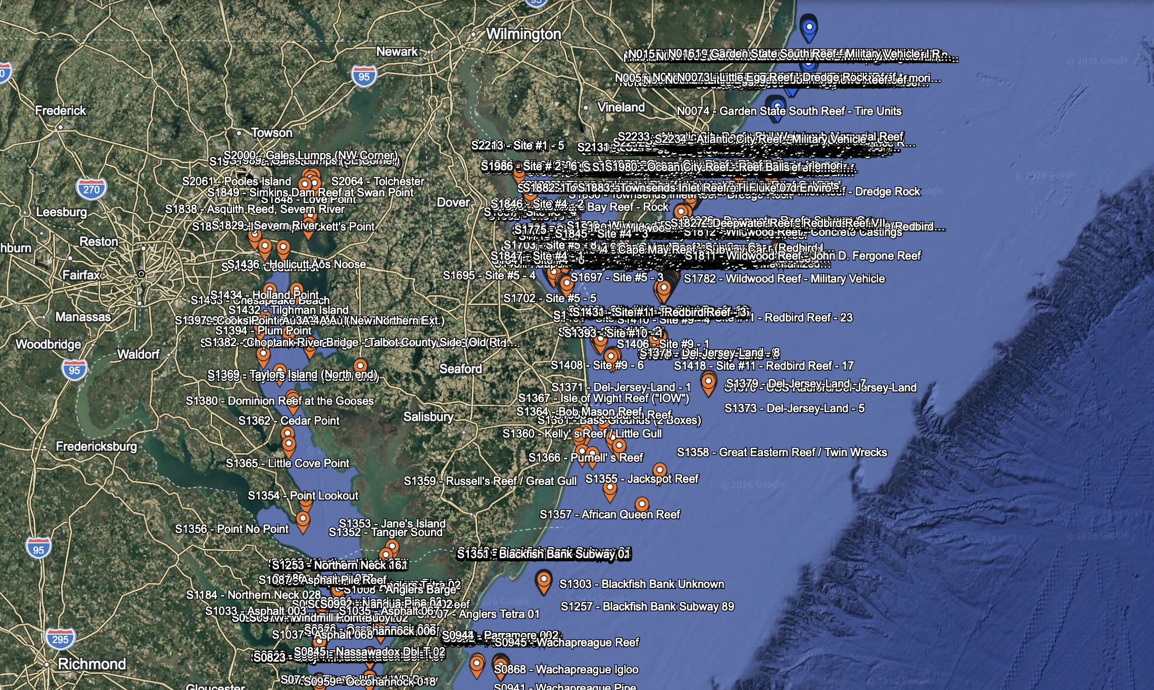
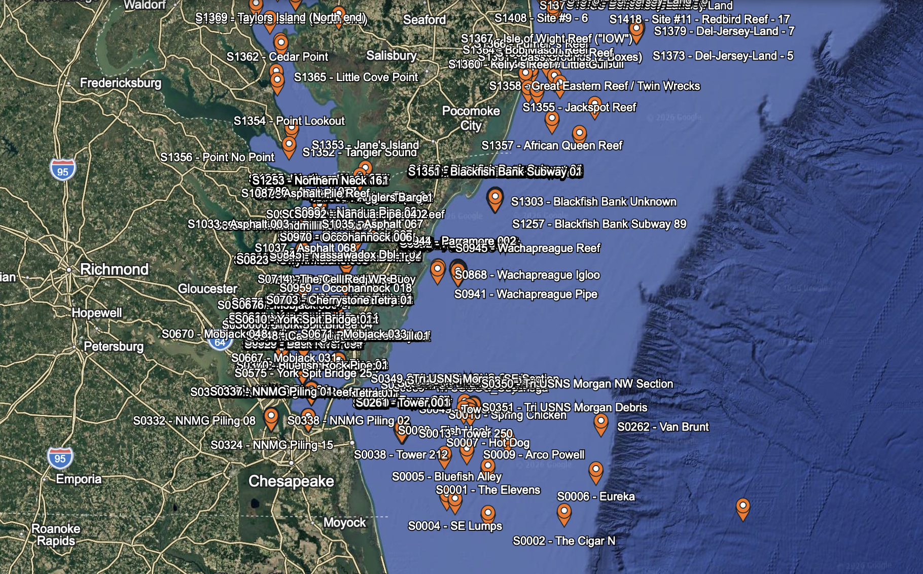
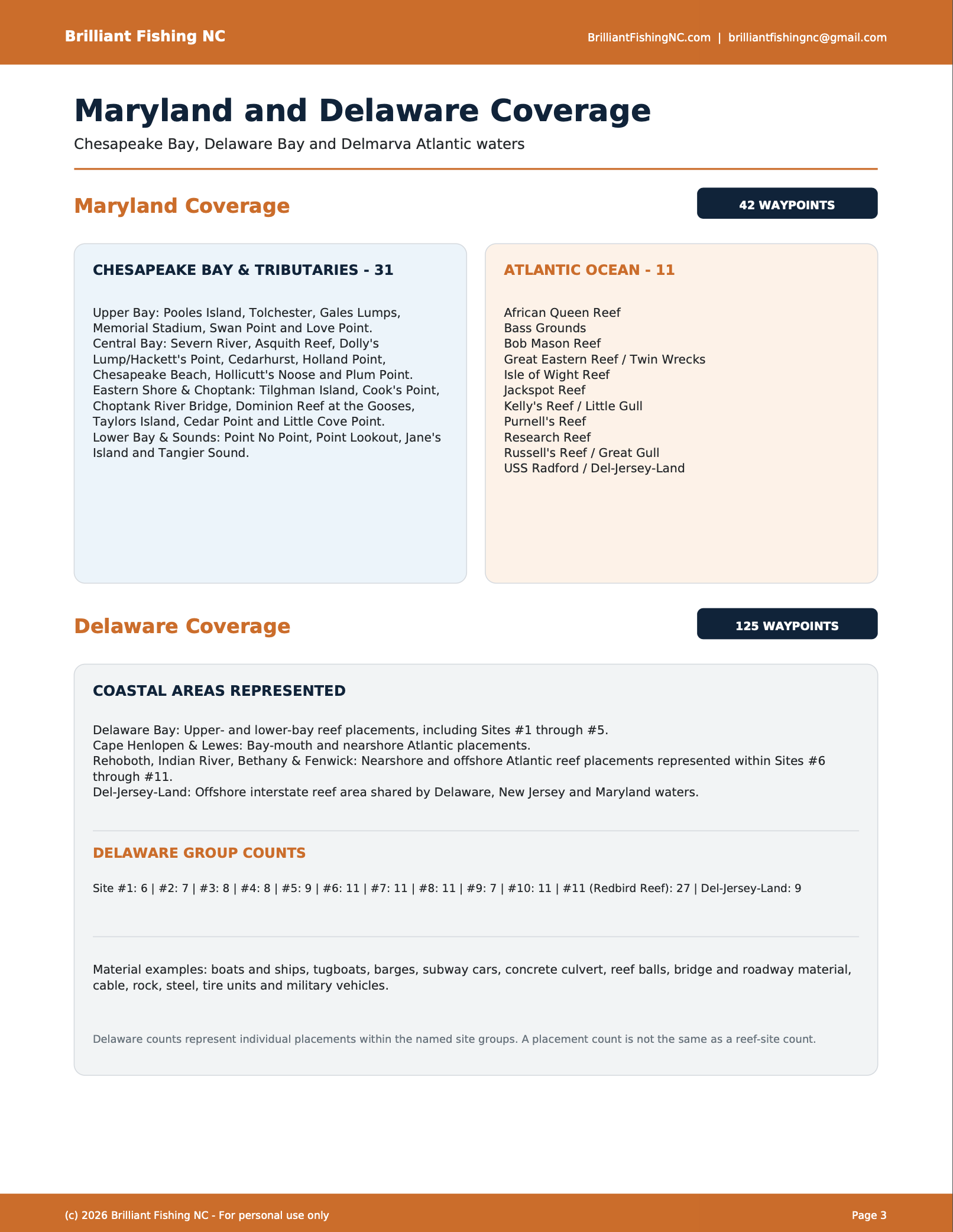
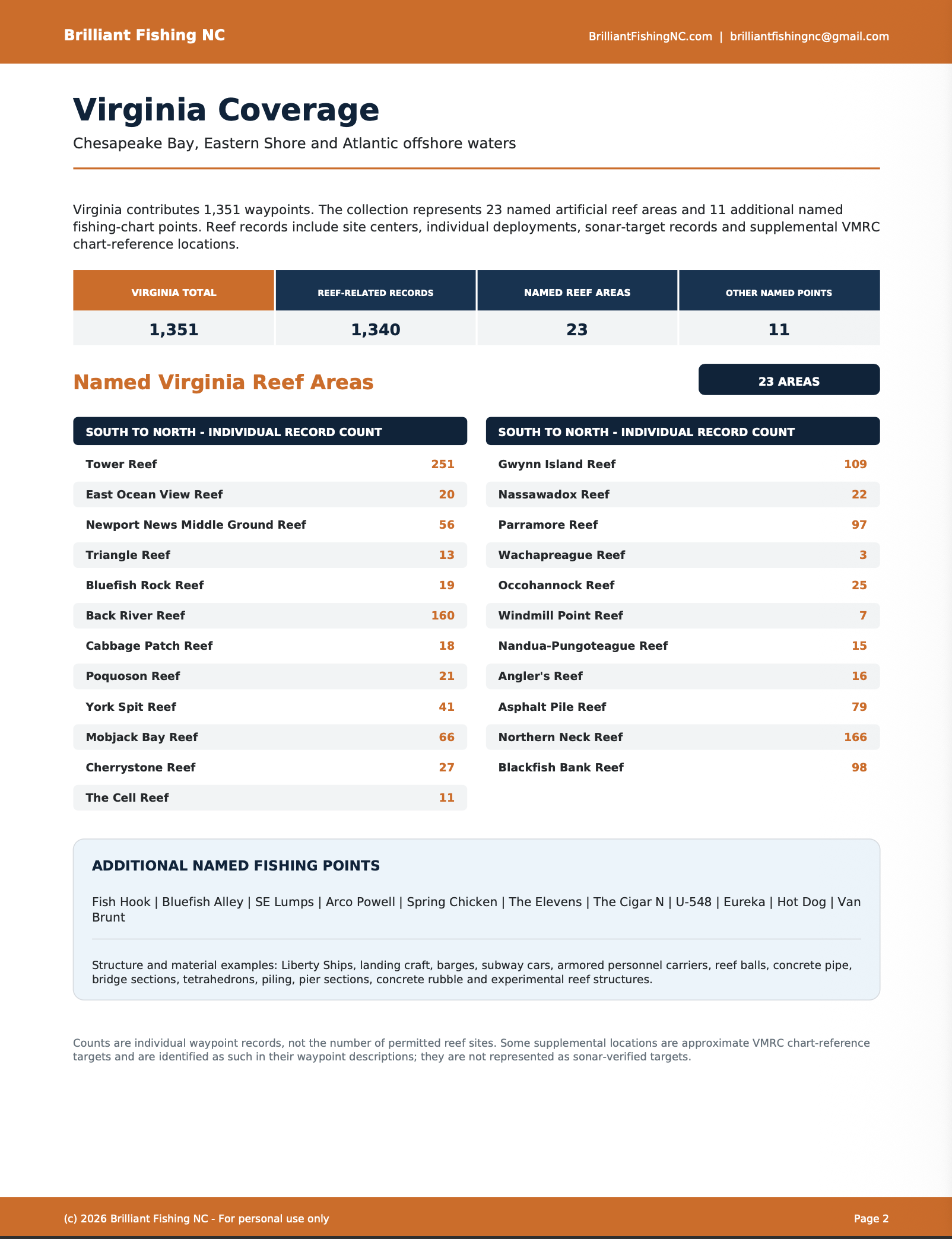
Virginia coverage includes 23 named artificial reef areas, including Tower Reef, Triangle Reef, Back River Reef, Parramore Reef, Blackfish Bank Reef, Northern Neck Reef, York Spit Reef and many others.
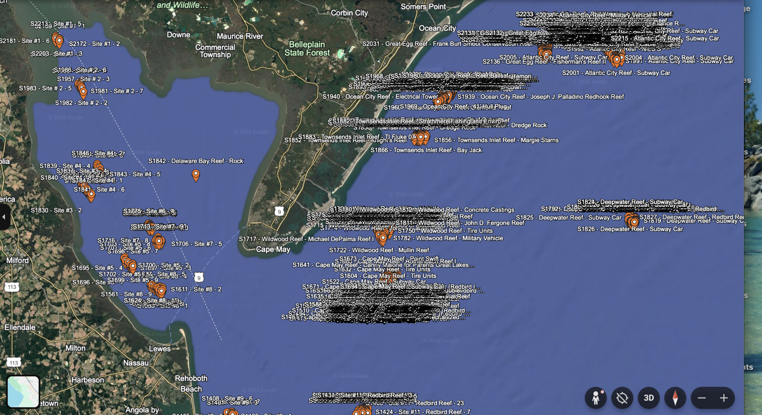
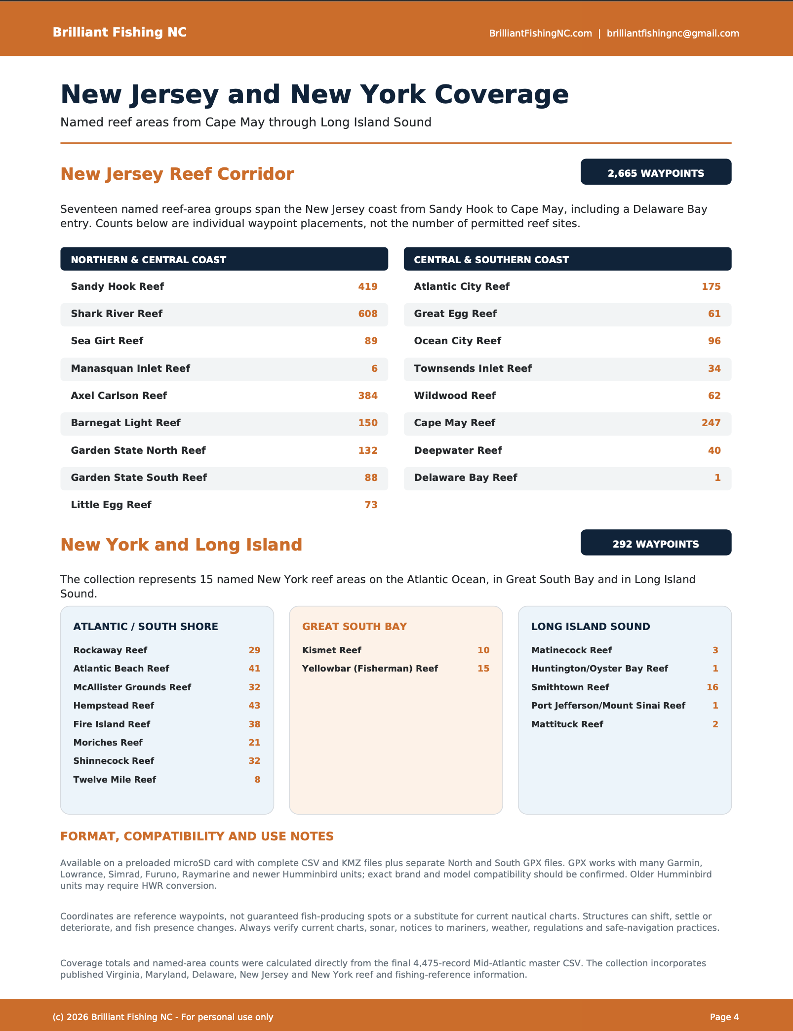
Additional coverage includes Chesapeake Bay and Maryland Atlantic locations, Delaware Bay and coastal reef sites, Cape May, Atlantic City, Little Egg, Barnegat Light, Axel Carlson, Shark River, Sandy Hook, Fire Island, Shinnecock and numerous other named fishing and reef areas.
WHAT’S INCLUDED
• Mid-Atlantic South GPX – 2,234 waypoints
• Mid-Atlantic North GPX – 2,241 waypoints
• Complete KMZ – all 4,475 waypoints for Google Earth
• Complete CSV – all waypoint names, descriptions and coordinates
• Four-page Mid-Atlantic coverage report
• Digital waypoint transfer and chartplotter instructions
• Read-me file with usage and license information
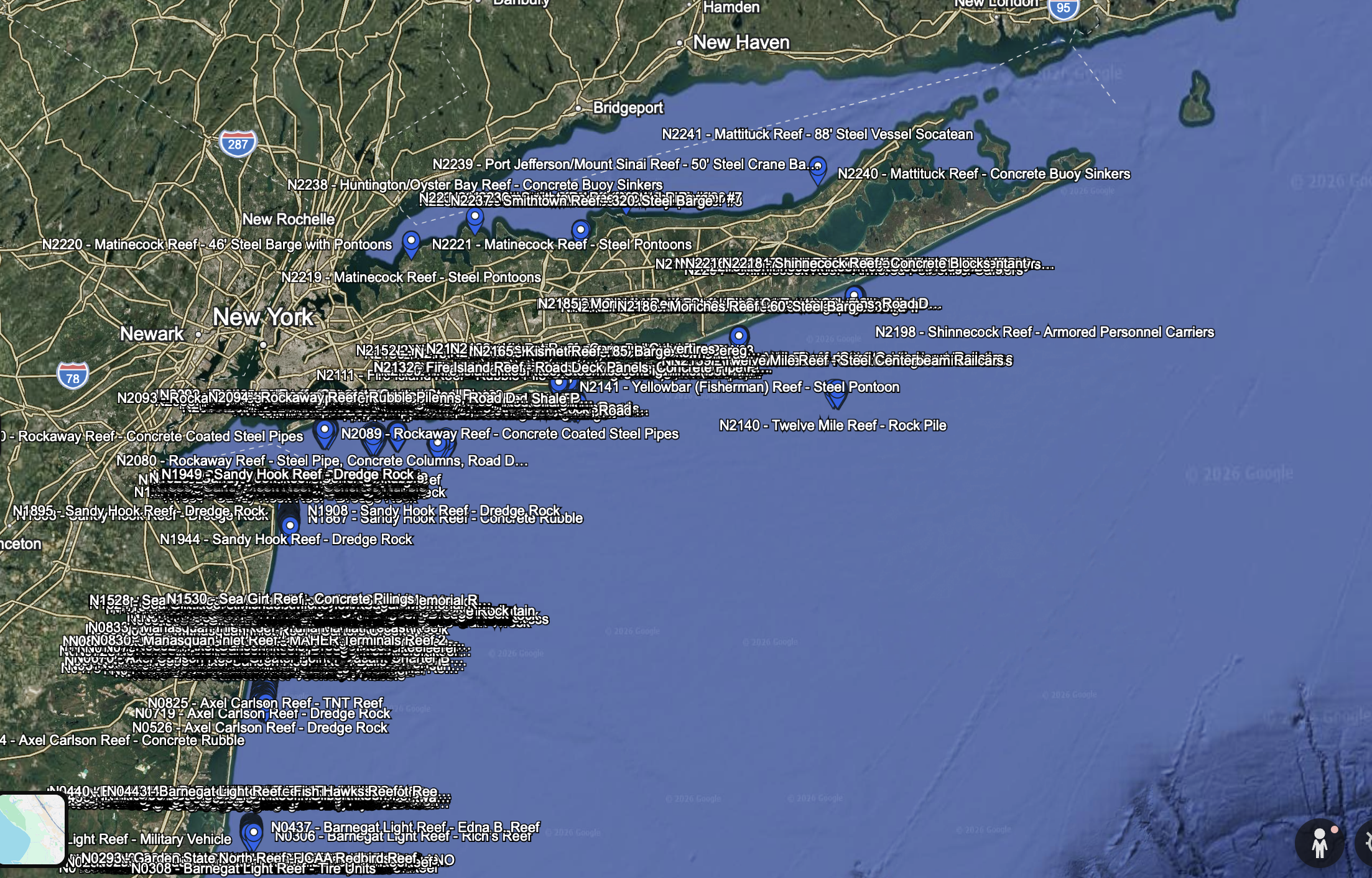
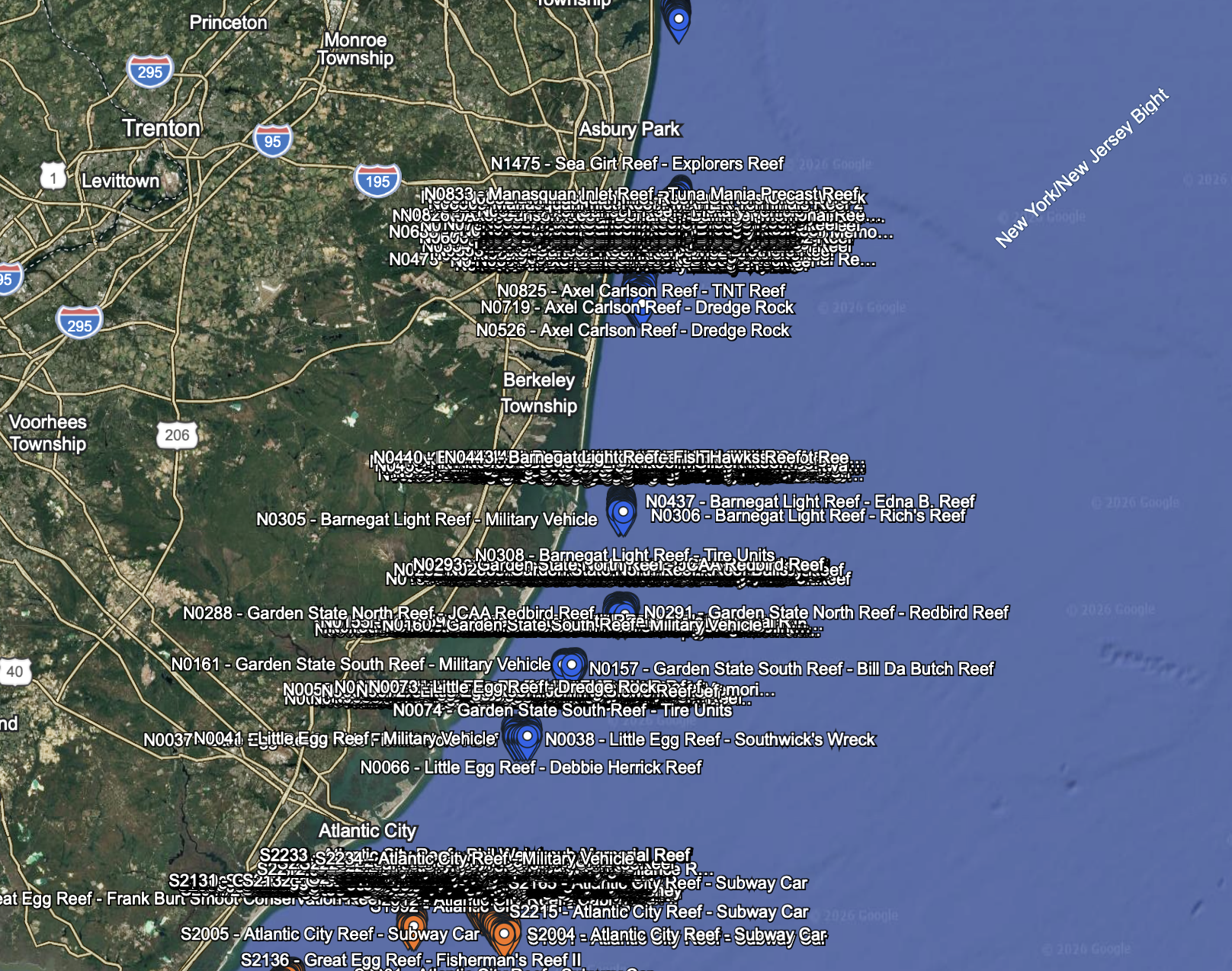
The complete Google Earth KMZ uses orange pins for the South set and blue pins for the North set. Each pin includes a visible waypoint label and full original name.
CHARTPLOTTER COMPATIBILITY
GPX files are commonly supported by many:
• Garmin
• Lowrance
• Simrad
• Furuno
• Raymarine
• Newer Humminbird units
Exact compatibility depends on the chartplotter’s brand, model and software. Please check your unit’s waypoint-import requirements before purchasing.
Some older Humminbird and legacy HELIX units may require HWR conversion. Contact Brilliant Fishing NC before purchasing if you are unsure about your particular model.
WAYPOINT CAPACITY
Many Garmin chartplotters have a 5,000-waypoint capacity. This complete collection contains 4,475 waypoints, so existing waypoints already stored in the unit reduce the available capacity.
The separate North and South GPX files allow you to import only the portion you need. Always back up existing chartplotter data before importing a large waypoint collection.
DIGITAL DELIVERY
This is an instant digital download. No physical microSD card will be mailed.
After purchasing, download the ZIP file to your computer, unzip it and transfer the appropriate GPX file to a compatible memory card for your chartplotter. The included PDF provides general transfer and import instructions.
WHY CHOOSE BRILLIANT FISHING NC?
• Broad five-state Mid-Atlantic coverage
• 4,475 organized reference waypoints
• Separate regional GPX files for manageable importing
• Complete Google Earth and spreadsheet reference files
• Unique chartplotter-friendly waypoint identifiers
• No subscription or recurring fee
• Instructions and customer support included
IMPORTANT NAVIGATION INFORMATION
These coordinates are provided as reference waypoints and are not guaranteed fish-producing spots. They are not a replacement for official nautical charts, current notices to mariners, sonar, weather information or prudent seamanship.
Reef materials, wrecks, depths, obstructions and bottom conditions can shift or change. Always cross-reference current charts, verify locations with sonar and follow all applicable regulations and safe-navigation practices.
PERSONAL-USE LICENSE
This purchase grants a personal, single-vessel license for use by one purchaser on one privately owned vessel. You may install the files on compatible electronics aboard that vessel and retain one private backup copy.
These files may not be copied, shared, resold, redistributed, transferred, posted online or supplied to another person. Charter, guide, commercial, resale or other business use is prohibited without prior written permission from Brilliant Fishing NC.
Purchase does not transfer ownership, reproduction rights or commercial-use rights to the underlying waypoint collection.
Brilliant Fishing NC
BrilliantFishingNC.com
brilliantfishingnc@gmail.com

Reviews
There are no reviews yet.