
Description
A BETTER STARTING POINT FOR FISHING THE MID-ATLANTIC
Spend less time searching scattered databases and more time exploring promising water.
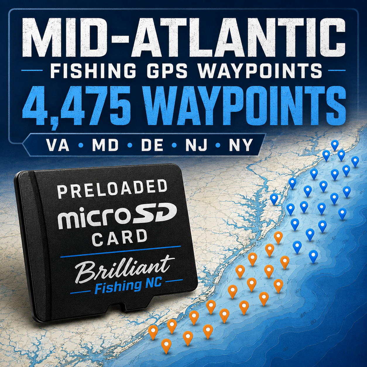
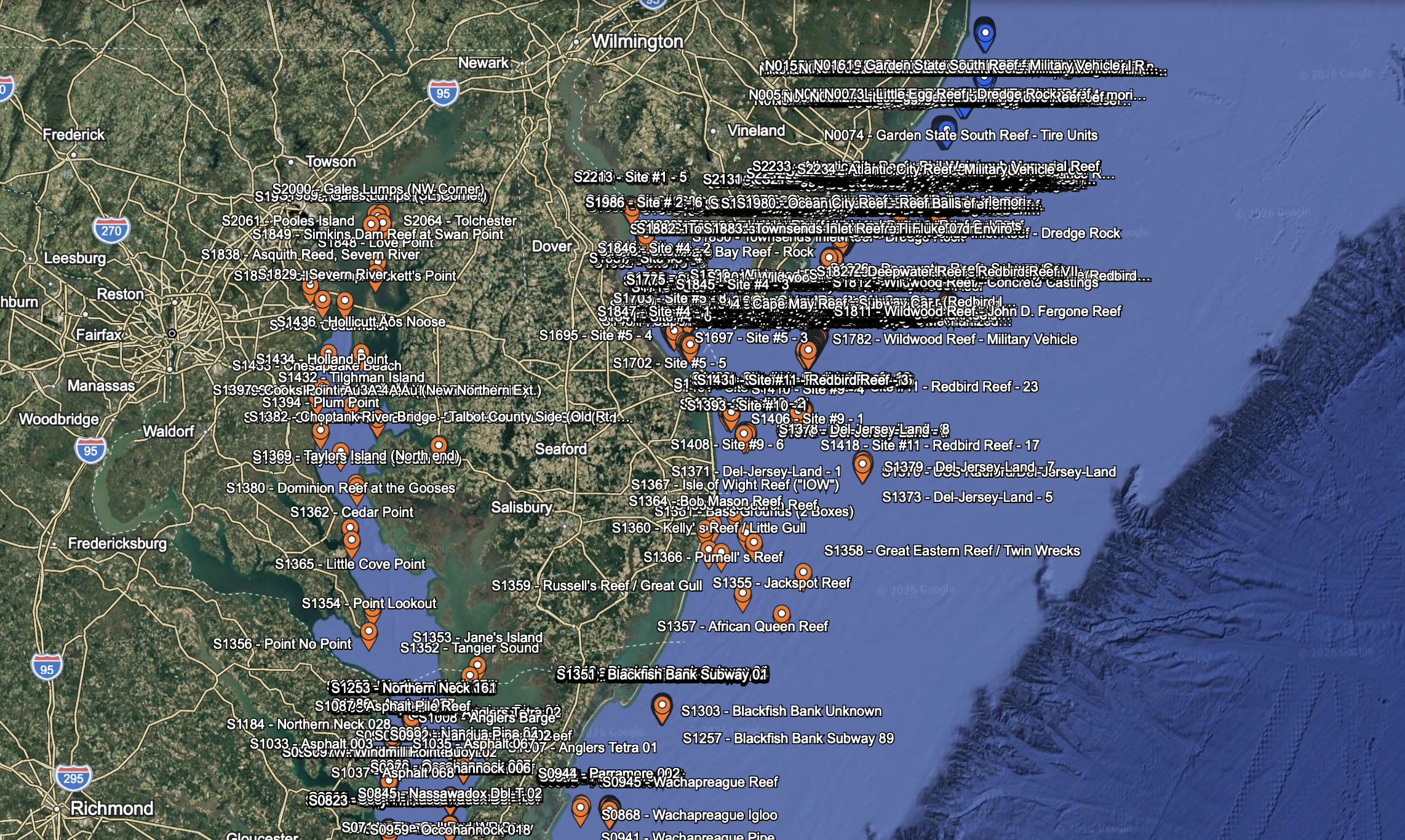
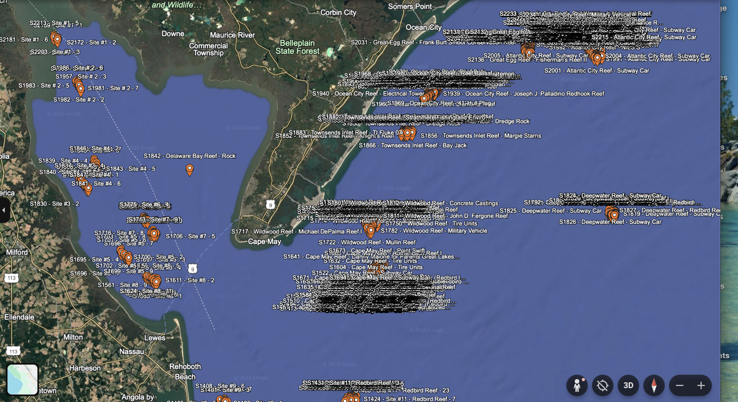
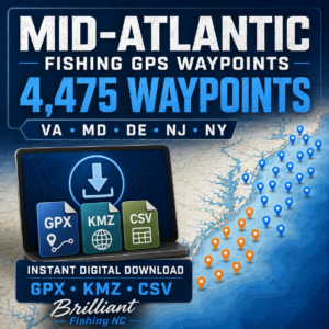
This Mid-Atlantic Fishing GPS Waypoint Package contains 4,475 organized fishing and marine-structure locations covering Virginia, Maryland, Delaware, New Jersey, and New York.
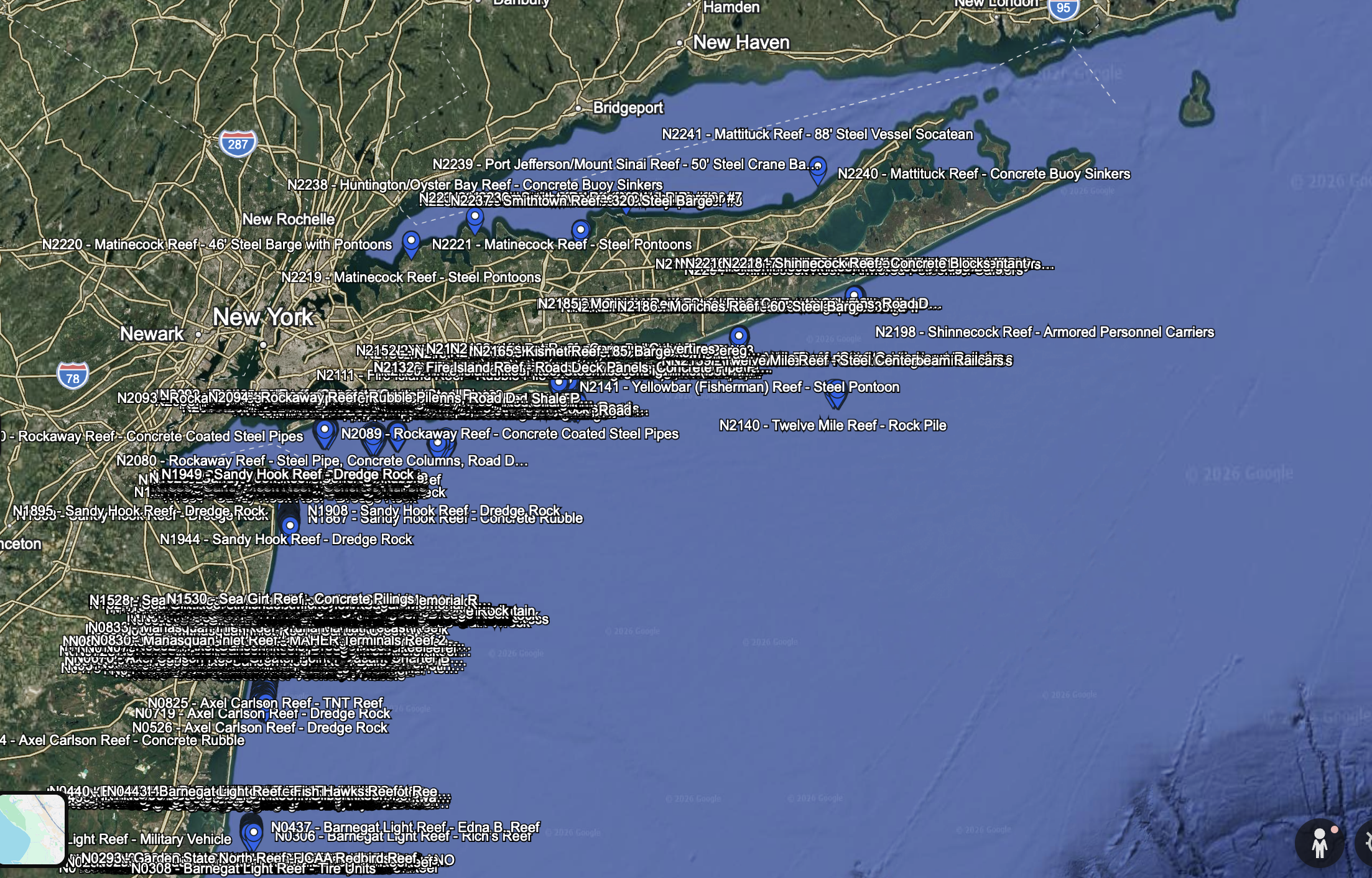
Coverage extends from the Chesapeake Bay and Virginia coast north through Delaware Bay, New Jersey, New York, Long Island, and selected waters of Long Island Sound.
The information has been gathered, cleaned, reviewed, and organized into practical files for use with compatible marine chartplotters and Google Earth. This is not simply an unorganized bulk data dump.
Your complete package is supplied on a preloaded microSD card and shipped directly to you.
WHAT’S INCLUDED
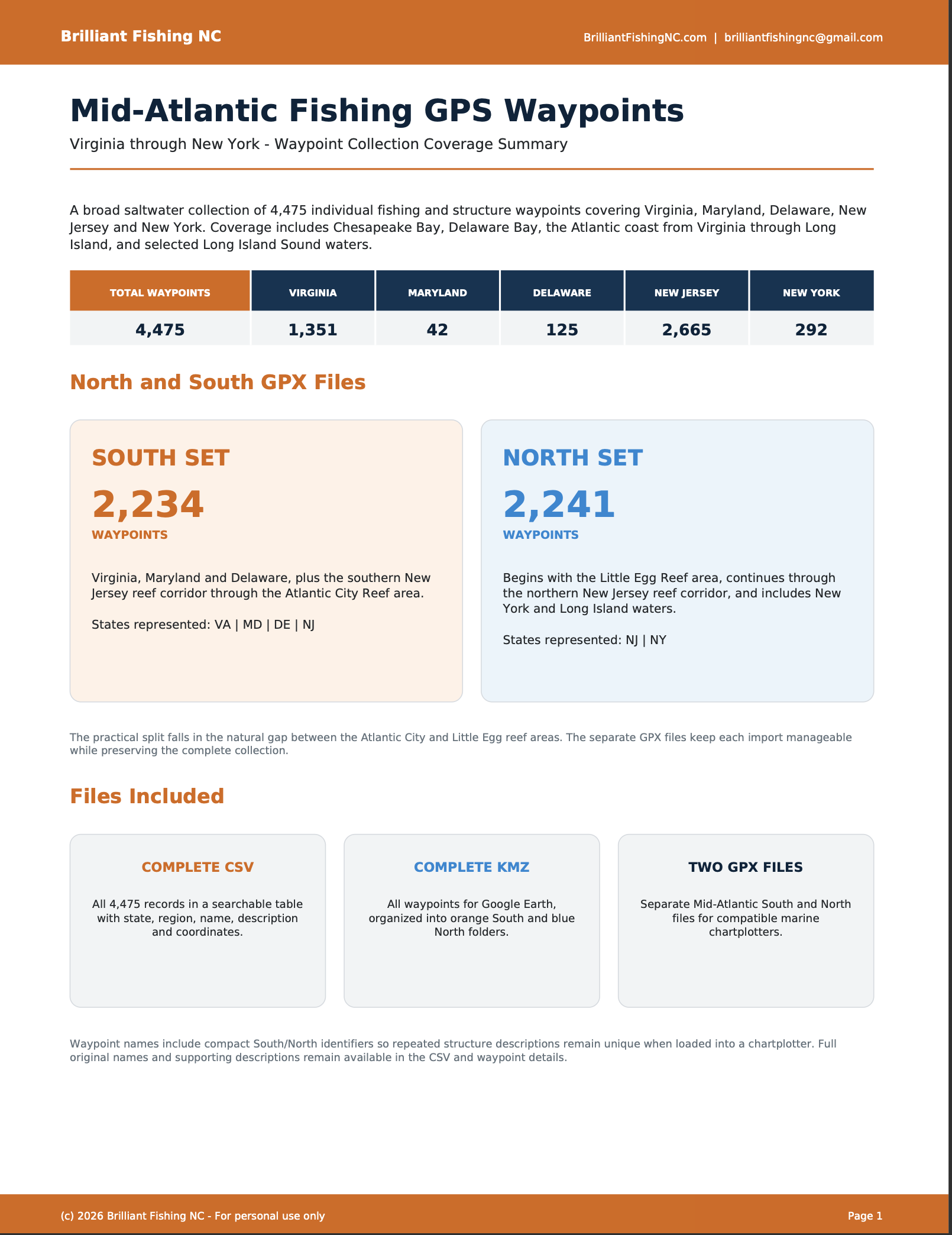
The complete package contains 4,475 waypoints:
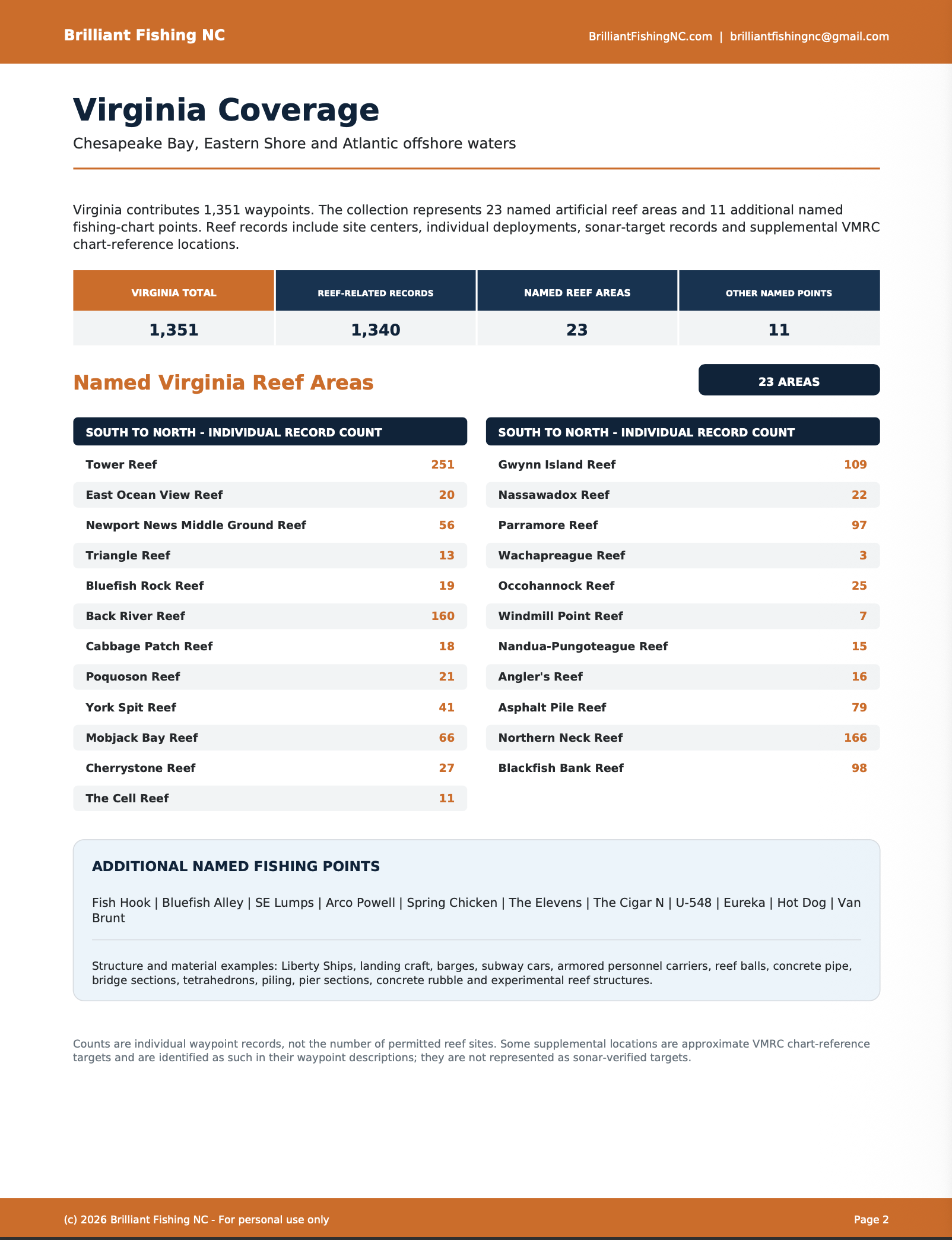
• Virginia: 1,351 waypoints
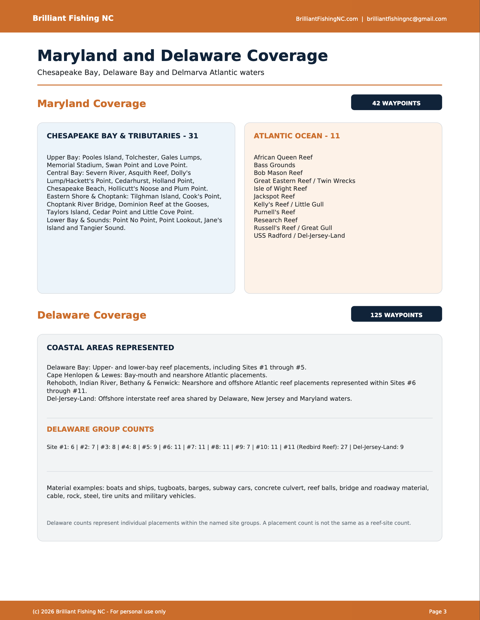
• Maryland: 42 waypoints
• Delaware: 125 waypoints
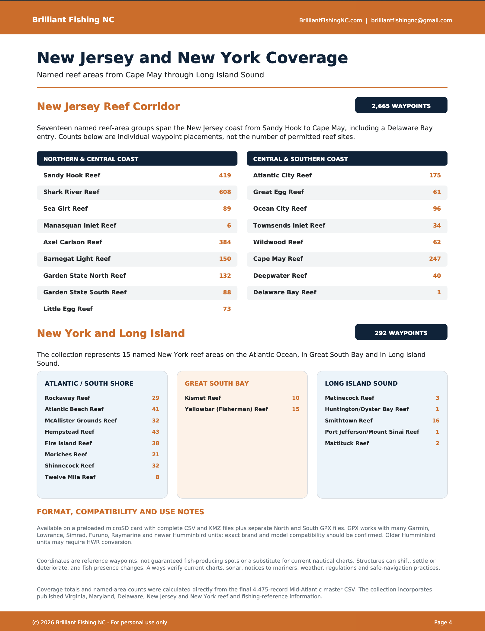
• New Jersey: 2,665 waypoints
• New York: 292 waypoints
Coverage includes artificial reefs, wrecks, obstructions, structure, fishing-related locations, and other potentially productive areas represented in the underlying source data.
NORTHERN AND SOUTHERN CHARTPLOTTER FILES
To make this large collection easier to import and manage on marine electronics, the GPX waypoints are divided into two approximately equal regional files.
SOUTHERN MID-ATLANTIC — 2,234 WAYPOINTS
Includes Virginia, Maryland, Delaware, and southern New Jersey through the Atlantic City Reef area.
NORTHERN MID-ATLANTIC — 2,241 WAYPOINTS
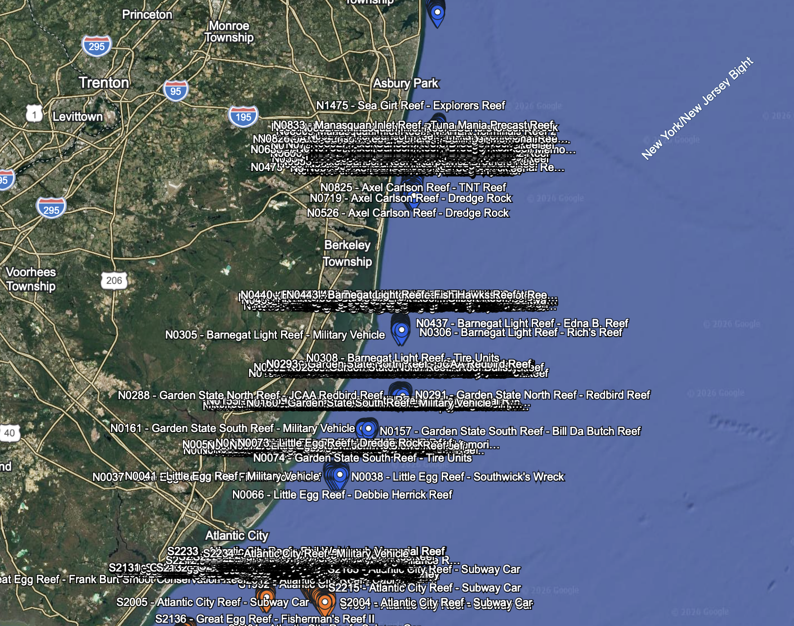
Begins around the Little Egg Reef area and continues through northern New Jersey, New York, Long Island, and selected waters of Long Island Sound.
The regional division falls between the Atlantic City and Little Egg reef areas. Customers fishing near the dividing line may install both GPX files if their equipment has sufficient waypoint capacity.
FILES INCLUDED ON YOUR microSD CARD
• Southern Mid-Atlantic GPX file — 2,234 waypoints
• Northern Mid-Atlantic GPX file — 2,241 waypoints
• Complete Mid-Atlantic KMZ file for Google Earth
• Complete Mid-Atlantic CSV waypoint file
• Detailed PDF coverage report
• Digital waypoint installation instructions
The complete KMZ and CSV files contain all 4,475 waypoints. Only the chartplotter GPX files are divided into Northern and Southern regions.
HOW THE microSD CARD WORKS
This is a waypoint-transfer card, not a navigational chart card.
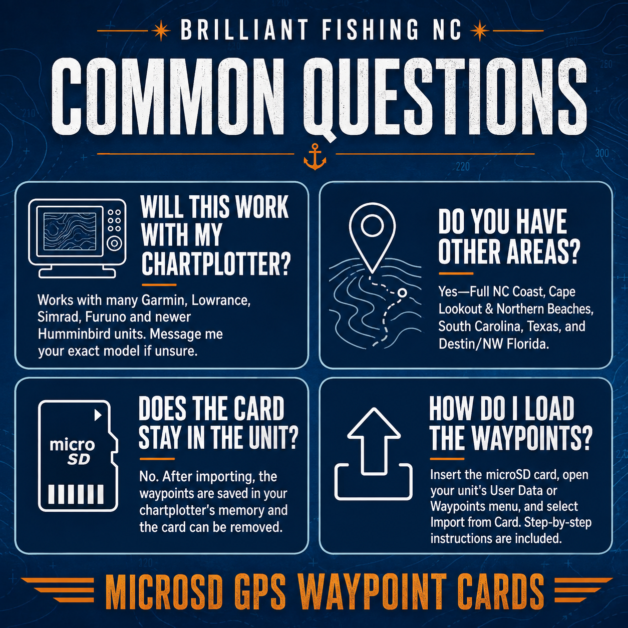
Insert the card into a compatible chartplotter or computer and follow the appropriate import procedure for your equipment. Once the waypoints have been successfully imported and saved to the chartplotter’s internal memory, the card generally does not need to remain in the unit.
Do not erase, reformat, or overwrite the card until you have confirmed that the waypoints imported successfully. We also recommend saving a backup copy of the files on a computer.
Import procedures, memory-card requirements, and waypoint limits vary by chartplotter model. Always consult your equipment’s owner’s manual before inserting or removing a memory card.
CHARTPLOTTER COMPATIBILITY
The included GPX files are compatible with many GPS units and marine chartplotters, including numerous models manufactured by:
• Garmin
• Lowrance
• Simrad
• Furuno
• Raymarine
• Humminbird
• Other systems capable of importing standard GPX waypoint files
Compatibility, import procedures, available memory, and waypoint limits vary by manufacturer and model.
Some Humminbird units, especially older models, may require conversion to Humminbird’s HWR format. Customers using an older Humminbird unit should contact Brilliant Fishing NC with the exact model number before ordering.
Please verify that your unit can import GPX files and confirm its memory-card and waypoint requirements before purchase. The Northern and Southern GPX files allow customers to install only the region they need or load the two regions separately.
If your chartplotter uses a full-sized SD-card slot, a compatible microSD-to-SD adapter may be required.
GOOGLE EARTH VIEWING
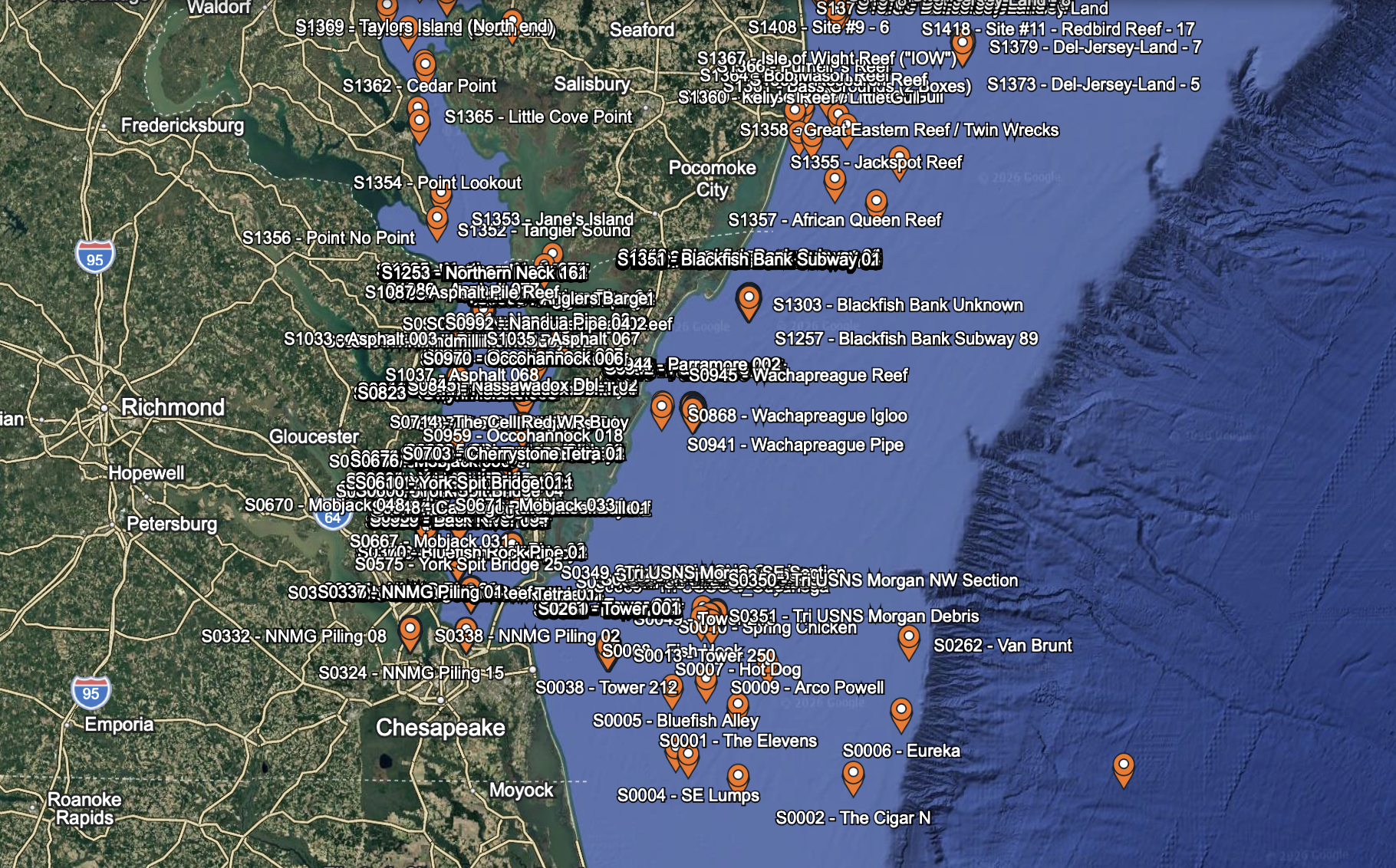
The card also contains a complete KMZ file for viewing all 4,475 locations in Google Earth on a compatible computer.
The KMZ file makes it easier to:
• Examine the overall coverage area
• Identify clusters of nearby locations
• Plan trips from different inlets and ports
• Review waypoint names and available details
• Decide whether to install the Northern file, Southern file, or both
The KMZ file is intended for Google Earth and is not normally imported directly into a chartplotter.
PHYSICAL DELIVERY
This is a physical product shipped on a preloaded microSD card. It is not an instant digital download.
Free USPS Ground Advantage shipping is included in the purchase price. Tracking information will be provided when your order ships.
Please carefully verify the shipping address entered during checkout.
WHY CHOOSE BRILLIANT FISHING NC?
This package brings a large amount of Mid-Atlantic fishing and marine-structure information together in one organized collection. The files have been cleaned and arranged to make them more practical for fishermen using Google Earth and modern chartplotters.
Rather than spending hours searching multiple sources, converting coordinates, removing obvious formatting problems, and organizing thousands of individual locations, you receive a prepared regional package with coverage documentation and installation guidance.
IMPORTANT INFORMATION
Waypoint locations are provided as fishing-reference and trip-planning information only. They are not intended to replace official nautical charts, current notices to mariners, depth soundings, local knowledge, safe navigation practices, or your own observations on the water.
Locations and descriptions may originate from government records, historical reports, artificial-reef information, marine databases, and other available sources. Underwater conditions can change. Structures may deteriorate, move, become buried, be removed, or differ from their recorded descriptions.
A waypoint identifies a location of potential interest. It does not guarantee the presence of fish, safe clearance, a visible structure, or successful fishing.
Always approach unfamiliar locations cautiously and verify conditions using your chartplotter, sonar, official charts, and good seamanship.
The purchaser is responsible for confirming chartplotter compatibility, memory-card requirements, available waypoint capacity, safe navigation, fishing regulations, permitted access, and all applicable state and federal laws.
RETURNS AND TECHNICAL ASSISTANCE
Because the microSD card contains licensed digital information that can be copied after receipt, opened, accessed, copied, or imported cards are generally not returnable.
If the card arrives damaged, the files cannot be accessed, or you receive the wrong product, contact Brilliant Fishing NC promptly so the problem can be corrected.
Compatibility problems resulting from a chartplotter’s file-format, memory-card, or waypoint limitations do not make the underlying waypoint package defective. Customers are encouraged to verify compatibility before ordering.
PERSONAL-USE LICENSE
By purchasing, receiving, installing, copying, or using these files, you accept a personal, non-transferable license for one purchaser and one vessel at a time.
You may make reasonable backup copies for your own use and may transfer the files between devices that you personally use on that vessel.
You may not copy, share, email, post, sell, resell, redistribute, publish, transfer the card or files to another person or vessel, or use them for charter, guide, commercial fishing, mapping, resale, or any other commercial purpose without prior written permission from Brilliant Fishing NC.
Purchase of this product does not transfer ownership of the compiled files, organization, formatting, waypoint collection, documentation, or other intellectual property. All rights not expressly granted remain reserved by Brilliant Fishing NC.
For commercial-use or multi-vessel licensing, contact Brilliant Fishing NC before purchasing or using the files.

Reviews
There are no reviews yet.